Supplying Water For Over 60 Years

The Wheeler Ridge-Maricopa Water Storage District (“District”) is a public agency whose jurisdiction encompasses about 147,000 acres (230 square miles) of land south of Bakersfield in Kern County, California, at the extreme southern end of the San Joaquin Valley . Except for a few locations along Interstate 5, the District is exclusively rural. There are no cities or towns within the District’s boundaries.
About 89,000 acres of farmland are cultivated within the District in a typical year. The Governor Edmund G. Brown California Aqueduct extends through the District for about 34 miles and nearly all of the surface water entering the District is conveyed through the Aqueduct. The Kern County Water Agency holds a long-term contract with the State of California for a State Water Project supply, of which the District’s contracted share is 197,088 acre-feet per year (when the State allocation is 100%). State Water Project supplies in turn are distributed to 72,081 acres of land within the District’s Surface Water Service Area under the terms of recorded long-term agricultural water service contracts. Outside of the Surface Water Service Area, an additional 26,000 acres are farmed on groundwater augmented from time to time with temporary surface water and approximately 21,000 acres are either fallow or used for utility yards, tank farms, cotton gins, and solar fields. Finally, 28,000 acres are undeveloped and used primarily for grazing and oil production.
Agriculture expanded rapidly in the southern San Joaquin Valley after World War II. And in that region located south of the Kern River alluvial fan that would eventually become the District, reliance on groundwater for irrigation led to a pattern of steadily declining water levels. Many forward-thinking landowners believed that an imported surface water supply was needed to enable the long-term sustainability of agriculture in the region. The District was formed on August 11, 1959 under provisions of the California State Water Code for the purpose of securing a surface water supply from the Feather River Project (now the State Water Project). In an election held November 14, 1967, landowners voted to authorize a District Project including authority to execute a contract for a State Water Project supply and construct a water distribution system.
Surface water deliveries began in 1970. To date, over 8.5 million acre-feet of untreated surface water supplies have been delivered to farm and ranches within the District. Except in drought years, imported surface supplies are sufficient for most crops within the District’s Surface Water Service Area and negate the need for ground water pumping. Consequently, the decline of ground water levels within the District was halted and then reversed beginning in the 1970s and 1980s. By the 1990s, studies commissioned by the District concluded that importation of SWP had “resulted in elimination of the ground water overdraft and caused ground water pumping lifts to be significantly less than they would have been without the Project”. However, by the 1990’s State Project supplies became increasingly unreliable, and the District sought additional dry year reliability by acquiring 16 new water wells and by participating in the Kern Water Bank, the Pioneer Project, and the Berrenda Mesa Project. Long negotiations at the State level resulted in the Monterey Amendments to the State Water Project contracts and significant improvements to water supply reliability and cost stability.
In November 2014, the California State legislature passed the Sustainable Groundwater Management Act (or SGMA, collectively contained in SB 1168, SB 1319, and AB 1739). SGMA mandates that groundwater basins designated by Department of Water Resources as high or medium priority develop groundwater sustainability plans (GSPs).
Although sustainabilitymay be a new concept to some, the District’s mission has been centered in sustainability from the beginning, and the financial commitments, long-term bond obligations on the land, creativity, and effort that have been required to build the District and operate it for over half a century demonstrate dedication to good stewardship of the land and sustainable use of the groundwater basin. Moreover, a number of plans and studies were commissioned by the District over the years to help guide its project, including the Report on Optimization and Enhancement of the Water Supplies of Kern County (Associated Engineering Consultants, 1983), Groundwater Studies (Bookman-Edmonston, 1995), and AB3030 Groundwater Management Plan (Todd Engineers, 2007). Most recently, the KGA GSA published its Groundwater Sustainability Plan (GSP) in January 2020 and the District published its Management Area Plan as a part of the KGA GSA’s GSP also in January 2020.
The District played an active role in the formation of the Kern Groundwater Authority, forerunner to the Kern Groundwater Authority Groundwater Sustainability Agency (KGA GSA) even before SGMA became law and helped to form the White Wolf Basin Groundwater Sustainability Agency (WWGSA) soon thereafter. About two-thirds of District lands (i.e., all lands located north and west of the White Wolf fault) lie within the KGA GSA and the balance of lands (i.e., lands located south and east of the White Wolf fault) belong to the White Wolf GSA.
The District is governed by an elected nine-member Board of Directors and operated by a staff of 43 employees. The 2021 budget totals approximately $80.8 million to pay for various water supplies, salaries and benefits, energy for pumping, maintenance of the District’s water distribution system, and debt obligations on water banking projects.
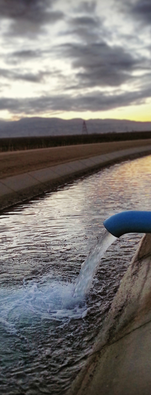
The District owns and operates a distribution system of nearly 300 miles of pipelines, 137 booster pumps, 14 wells, and 7 miles of concrete-lined canal. Depending on land leasing patterns in a given year, the District serves between 100 and 150 customers. The District provides no water treatment. All water delivered is in a raw, untreated condition and is not suitable for human consumption without treatment.
The District has a semi-arid climate. The growing season is among the longest in the San Joaquin Valley, averaging about 300 days above 32 degrees Fahrenheit and almost 365 days above 28 degrees Fahrenheit. Temperatures exceed 90 degrees Fahrenheit about 110 days per year. The average precipitation of about 7 inches per year falls almost entirely in the winter and spring.
About 97% of the land within the District is irrigable, with 90% of the soils within the Surface Water Service Area classified as having wide crop adaptability with no limitations. Major crops include wine and table grapes (28,000 acres), citrus (22,688 acres), almonds (15,274 acres), pistachios (5,061 acres), and carrots (3,300 acres), but a wide variety of produce and field crops are grown such as cotton, safflower, wheat, alfalfa, lettuce, melons, onions, peppers, potatoes, tomatoes, asparagus, blueberries, cherries, walnuts, and plums.